Translate

Κυριακή 10 Μαρτίου 2013

1. Highway 1, Big Sur, California

bixby-bridge-highway-1-big-sur-california

State Route 1 (SR 1) is a major north-south state highway that runs along most of the Pacific coastline of the U.S. state of California. The highway is famous for running along some of the most beautiful coastlines in the USA, leading to its designation as an All-American Road.

Highway 1 enters the Big Sur region crossing the San Carpoforo Creek just south of the Monterey County line. For about 90 miles (140 km) from the San Carpoforo Creek to the Carmel River, the road winds and hugs the cliffs of Big Sur, passing various coastal parks in the area. The road also briefly leaves the coast for a few miles and goes through a redwood forest in the Big Sur River valley. This segment of the highway, built between 1919 and 1937, also crosses several historic bridges, including the scenic Bixby Creek Bridge shown above. [Source]

2. Furka Pass, Switzerland

Furkapassroute-in-Switzerland-as-seen-from-Grimselpassroute
Photograph by Cooper.ch

Furka Pass (el. 2429 m.) is a high mountain pass in the Swiss Alps connecting Gletsch, Valais with Realp, Uri. The Furka Pass was used as a location in the James Bond film Goldfinger. [Source]

3. The Atlantic Road, Norway


Photograph via KULfoto.com

The drunk bridge / Il ponte ubriaco
Photograph by Giorgio Ghezzi

Opened on July 7, 1989, the Atlantic Road is a National Tourist Route and was honoured as Norway’s Construction of the Century in 2005. The Atlantic is an 8.3 kilometer (5.2 miles) section of Country Road 64 which runs between the towns of Kristiansund and Molde, the two main population centres in the county of More og Romsdal in Fjord, Norway. The road is built on several small islands and skerries, which are connected by several causeways, viaducts and eight bridges. For more information check out this featured post on the Sifter.

4. White Rim Road, Canyonlands National Park, Utah

white-rim-road-canyonlands-national-park-utah

The 100-mile White Rim Road loops around and below the Island mesa top and provides expansive views of the surrounding area. Trips usually take two to three days by four-wheel-drive vehicle or three to four days by mountain bike. All vehicles and bikes must remain on roads. ATVs and non-street legal dirt bikes are not permitted. Pets are also not permitted, even in vehicles.

Under favorable weather conditions, the White Rim Road is considered moderately difficult for high-clearance, four-wheel-drive vehicles. The steep, exposed sections of the Shafer Trail, Lathrop Canyon Road, Murphy’s Hogback, Hardscrabble Hill, and the Mineral Bottom switchbacks make the White Rim loop a challenging mountain bike ride, and require extreme caution for both vehicles and bikes during periods of inclement weather. [Source]

5. Tianmen Mountain Road, Hunan, China

Tianmen Mountain National Geopark winding mountain road_3
Photograph by About Tiger on Flickr

Road to Tianmen mountain
Photograph by Peter Cheung

Tianmen Mountain is a mountain located within Tianmen Mountain National Park, Zhangjiajie, in northwestern Hunan Province, China. A cable car operates from nearby Zhangjiajie railway station to the top of the mountain. It features 98 cars and a total length of 7,455 meters and an ascent of 1,279 meters. The highest gradient is an unusual 37 degrees. There is also an 11 km road with 99 bends that reaches the top of the mountain and takes visitors to Tianmen cave, a natural hole in the mountain at a height of 131.5 meters. [Source]

6. Seven Mile Bridge, Florida Keys

seven-mile-bridge-florida-united-states

The Seven Mile Bridge is a famous bridge in the Florida Keys, in Monroe County, Florida, United States. It connects Knight’s Key (part of the city of Marathon, Florida) in the Middle Keys to Little Duck Key in the Lower Keys. Among the longest bridges in existence when it was built, it is one of the many bridges on US 1 in the Keys, where the road is called the Overseas Highway. [Source]

7. Chapman’s Peak Drive, Cape Town, South Africa

Chapman's Peak Drive
Photograph by Ismail Omar

Chapman’s Peak Drive winds it way between Noordhoek and Hout Bay on the Atlantic Coast of the south-western tip of South Africa. The 9km route, with its 114 curves, skirts the rocky coastline of Chapman’s Peak (593m). The drive is affectionately known as “Chappies” and offers stunning 180° views with many areas along the route where you can stop and take in the exquisite scenery. [Source]

8. Stelvio Pass, Eastern Alps, Italy

stelvio-pass-eastern-alps-italy

The Stelvio Pass, located in Italy, at 2757 m (9045 feet) is the highest paved mountain pass in the Eastern Alps, and the second highest in the Alps, slightly below the Col de l’Iseran (2770 m, 9088 feet). Stelvio was also picked by the British automotive show Top Gear as its choice for the “greatest driving road in the world”, although their search was concentrated only in Europe. This conclusion was reached after the team went in search of a road that would satisfy every “petrolhead’s” driving fantasies in the premiere of the show’s 10th season. Top Gear later decided that the Transfăgărăşan Highway in Romania was possibly a superior driving road. [Source]

9. Col de Turini, France

Untitled

The Col de Turini (el. 1607 m) is a high mountain pass in the Alps in the department of Alpes-Maritimes in France. It lies near Sospel, between the communes of Moulinet and La Bollène-Vésubie in the Arrondissement of Nice. It is famous for a stage of the Monte Carlo Rally which is held on the tight road with its many hairpin turns. The Col de Turini has also featured three times in the Tour de France (1948, 1950 and 1975) averaging 7.2% over 15.3 km when approached from the East starting at the valley of the river Vésubie. [Source]

10. Guoliang Tunnel Road, China

guoliang-tunnel-china
Photograph via Blog-O-Rama

The Guoliang Tunnel is carved along the side of and through a mountain in China. The tunnel is located in the Taihang Mountains which are situated in the Henan Province of China. If you want to get there, you should start your trip in Xinxiang. Leave the city by driving north on Huanyu Avenue (the S229). After 13 miles you’ll enter the town of Huixian. Stay on the S229 for 15 miles more until you reach the junction with the S228. Turn left here and keep following the S229. After 8 miles you reach the village of Nanzhaizen. Turn left again and follow directions to Guoliang, 8 miles further. [Source]

11. Denali Highway, Alaska

Denali Highway
Photograph by Tom Roche

Denali Highway (Alaska Route 8) is a lightly traveled, mostly gravel highway in the U.S. state of Alaska. It leads from Paxson on the Richardson Highway to Cantwell on the Parks Highway. Opened in 1957, it was the first road access to Denali National Park (then known as Mount McKinley National Park). The Denali is 135 miles (217 km) in length. [Source]

12. Karakoram Highway, China/Pakistan

flight to Gilgit 22
Photograph by bjapuri (Ed Sentner)

The Karakoram Highway (KKH) is the highest paved international road in the world. It connects China and Pakistan across the Karakoram mountain range, through the Khunjerab Pass, at an elevation of 4,693 m/15,397 ft. It connects China’s Xinjiang region with Pakistan’s Gilgit–Baltistan and Khyber Pakhtunkhwa regions and also serves as a popular tourist attraction. Due to its high elevation and the difficult conditions in which it was constructed, it is also referred to as the “Eighth Wonder of the World.” The Karakorum Highway is known informally as the KKH, and — within Pakistan — officially as the N-35; within China, officially as China National Highway 314 (G314). [Source]

13. Great Ocean Road, Australia

Great_Ocean_Road_Lorne_Australia

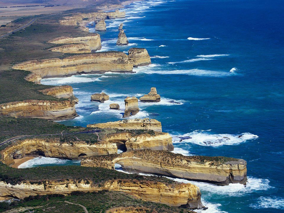
The Great Ocean Road is an Australian National Heritage listed 243-kilometre (151 mi) stretch of road along the south-eastern coast of Australia between the Victorian cities of Torquay and Warrnambool. The road was built by returned soldiers between 1919 and 1932, and is the world’s largest war memorial; dedicated to casualties of World War I. It is an important tourist attraction in the region, which winds through varying terrain alongside the coast, and provides access to several prominent landmarks; including the nationally significant Twelve Apostles limestone stack formations. [Source]

14. Sani Pass, KwaZulu-Natal, South Africa

sani pass kwazulu-natal province south africa

Sani Pass is located in the western end of KwaZulu-Natal province of South Africa on the road between Underberg and Mokhotlong, Lesotho. Sani Pass is a notoriously dangerous road that requires the use of a 4×4 vehicle. The pass is approximately 9 km in length and requires above average driving experience. While South African immigration at the bottom of the pass prohibits vehicles deemed unsuitable for the journey, the Lesotho border agents at the top generally allow vehicles of all types to attempt the descent. Border between the two countries closes at 4:00 pm every day and the Pass is often closed due to weather conditions, especially during winter. [Source]

15. Ruta 40, Argentina

Ruta 40

National Route 40 or RN40 (often called Ruta 40), is a route in western Argentina, stretching from Cabo Virgenes in Santa Cruz Province in the south to La Quiaca in Jujuy Province in the north, running parallel to the Andes mountains. The southern part of the route, a largely paved road through sparsely populated territory, has become a well-known adventure tourism journey.

Route 40 is the longest route in Argentina and one of the largest in the world (along with the U.S. Route 66 and the Stuart Highway in Australia. It is more than 5,000 km (3,107 mi) long and crosses 20 national parks, 18 major rivers, 27 passes on the Andes, and goes up to 5,000 m (16,404 ft) above sea level in Abra del Acay in Salta. [Source]

16. Going-to-the-Sun-Road, Glacier National Park, Montana

Going-to-the-Sun Road
Photograph by at38000feet on Flickr

Going-to-the-Sun Road was completed in 1932 and is a spectacular 50 mile, paved two-lane highway that bisects Glacier National Park east and west. It spans the width of the Park, crossing the Continental Divide at 6,646-foot-high Logan Pass. It passes through almost every type of terrain in the park, from large glacial lakes and cedar forests in the lower valleys to windswept alpine tundra atop the pass. Scenic viewpoints and pullouts line the road. In 1983 Going-To-The-Sun Road was included in the National Register of Historic Places and in 1985 was made a National Historic Civil Engineering Landmark. [Source]

17. Dadès Gorges, High Atlas, Morocco

Dades_Gorge_high-Atlas-Morocco
Photograph by Rosino

Carved over the centuries by the Dades River, the Dades Gorge is now a very popular destination for travellers in Morocco. Travellers in 4WD (with a guide) can follow a mountain loop (at certain times of the year), following Dades Gorge as far north as Agoudal, then turning south to head for Todra Gorge. It can be accessed from the small town of Boumaine which lies 116 km northeast of Ouarzazate and 53 km from Tinerhir. A sealed road runs for 63 km through the Gorge as far as Msemrir, after that 4WD is necessary. The best time to visit the lower valleys is from March to May and the mountains are best from May to July. [Source]

18. U.S. Route 550 ‘The Million Dollar Highway, Colorado

million-dollar-highway-us-route-550-colorado
Photograph by flamouroux on Flickr

U.S. Route 550 is a spur of U.S. Highway 50 that runs from Bernalillo, New Mexico to Montrose, Colorado in the western United States. The section from Silverton to Ouray is frequently called the Million Dollar Highway. The Million Dollar Highway stretches for about 25 miles (40 km) in western Colorado and follows the route of U.S. 550 between Silverton and Ouray, Colorado. It is part of the San Juan Skyway Scenic Byway. Between Durango and Silverton the Skyway loosely parallels the Durango and Silverton Narrow Gauge Railroad.

Though the entire stretch has been called the Million Dollar Highway, it is really the twelve miles (19 km) south of Ouray through the Uncompahgre Gorge to the summit of Red Mountain Pass which gains the highway its name. This stretch through the gorge is challenging and potentially hazardous to drive; it is characterized by steep cliffs, narrow lanes, and a lack of guardrails; the ascent of Red Mountain Pass is marked with a number of hairpin curves used to gain elevation, and again, narrow lanes for traffic—many cut directly into the sides of mountains. [Source]

19. Trollstigen, Rauma, Norway

Trollstigen_Norway

Trollstigen (English: Trolls’ Ladder) is a serpentine mountain road in Rauma, Norway, part of Norwegian National Road 63 connecting Åndalsnes in Rauma and Valldal in Norddal. It is a popular tourist attraction due to its steep incline of 9% and eleven hairpin bends up a steep mountain side. Trollstigen was opened on July 31, 1936, by King Haakon VII after 8 years of construction. During the top tourist season about 2,500 vehicles pass daily.

The road is narrow with many sharp bends, and although several bends have been widened during the years 2005 to 2012, vehicles over 12.4 metres long are prohibited from driving the road. At the 700 metres plateau there is a car park and several viewing balconies overlooking the bends and the Stigfossen waterfall. Trollstigen is closed during autumn and winter. A normal opening season stretches from mid-May to October, but may sometimes be shorter or longer due to changes in the weather conditions. [Source]

20. The Amalfi Coast, Italy

amalfi-coast-italy-road-to-sorrento
Photograph by Wade 48 on Flickr

The Amalfi Coast is widely considered Italy’s most scenic stretch of coastline, a landscape of towering bluffs, pastel-hued villages terraced into hillsides, corniche roads, luxuriant gardens, and expansive vistas over turquoise waters and green-swathed mountains. Deemed by UNESCO “an outstanding example of a Mediterranean landscape,” the coast was awarded a coveted spot on the World Heritage list in 1997. The Amalfi Coast lies along the southern flanks of the Sorrento Peninsula, a cliff-edged promontory that wanders out from the mainland at the southern end of the Bay of Naples. [Source]

21. Transfăgărășan, Romania

Transfagarasan road romania
Photograph by Horia Varlan

The Transfăgărășan or DN7C is the second-highest paved road in Romania. Built as a strategic military route, the 90 km of twists and turns run north to south across the tallest sections of the Southern Carpathians, between the highest peak in the country, Moldoveanu, and the second highest, Negoiu. The road connects the historic regions of Transylvania and Wallachia, and the cities of Sibiu and Pitești.

The road climbs to 2,034 metres altitude. The most spectacular route is from the North. It is a winding road, dotted with steep hairpin turns, long S-curves, and sharp descents. Top Gear host, Jeremy Clarkson, had said about Transfăgărășan that, “this is the best road… in the world” – a title the program’s presenters had previously given to the Stelvio Pass in Italy. [Source]


If you enjoyed this post, the Sifter
highly recommends:


42 of the World’s Most Beautiful Crater Lakes

December 22nd, 2012 Permalink If you approached the rim of a volcano and looked down into it, you might expect to see a lava pool, but if the volcano previously erupted and then the top of it collapsed into a huge bowl-shaped crater, or caldera, then what you might see when you peer over the rim is a beautiful crater lake. Sometimes the water is acidic and the lake has a bright greenish hue. Other times the water is a cloudy turquoise color, yet other times the lake may appear to be a very deep shade of blue. Crater Lake, Oregon, is one of the most well known, but crater lakes can be found all over the globe. If the volcano has been dormant for a long time, the water can be extremely clear because no river or streams flow into with sediment deposits. In some cases, water may have filled up an impact crater to form a lake, but this is less common. A few crater lakes were created by man via an atomic blast, but an artificially-created crater lake is the least common of all. All crater lakes were once a place where the earth experienced great violence, but now are a place of great beauty . . . even though the volcano can become active and violent again. Here are 44 photos of 42 of the world’s most beautiful crater lakes. [44 Photos]
Lake Quilotoa is a water-filled caldera and the westernmost volcano in the Ecuadorian Andes
Lake Quilotoa is a water-filled caldera and the western most volcano in the Ecuadorian Andes. The crater is about 2 miles wide and the lake is about 820 feet deep. It is tinted green by dissolved minerals. Photo #1 by Kevin Labianco

Deepest crater lake in the Uintas Mountains of Utah
Deepest crater lake in the Uintas Mountains of Utah. Photo #2 by Cordell Mandersen


Monsoon rains filled the crater lake, Lake Pinatubo in the Philippines
Lake Pinatubo, Philippines, formed after the 1991 eruption of Mount Pinatubo has filled with water from monsoon rains. At 800 m (2,600 ft), it is the deepest lake in the Philippines. Photo #3 by monggoy
Crater Lake at the Mouth of Taal Volcano in Luzon, Philippines
Lake Pinatubo is not the only such lake in the Philippines. This is the Crater Lake at the Mouth of Taal Volcano in Luzon. Photo #4 by Deck Chua
The Okama Crater Lake at Mount Zaō, Japan
The Okama Crater Lake at Mount Zaō, Japan. According to Wikipedia, it is “also known as the ‘Five Color Pond’ because it changes color depending on the weather.” It “lies in a crater formed by a volcanic eruption in the 1720s. The lake is 360 meters (1,200 ft) in diameter and 60 m (200 ft) deep, and is one of the main tourist attractions in the area.” Photo #5 by Laurenz Bobke
Lake Marjorie, Kings Canyon National Park
Lake Marjorie, Kings Canyon National Park. The photographer wrote, “Lakes in the High Sierra come in a number of colors. Lake Marjorie, at 11,132′ has an aquamarine ‘swimming pool’ tint. Crater Mountain dominates the skyline, with Pinchot Pass to the south. I was happy to see clouds at dawn, but by noon a fast moving storm was spitting hail, thunder, and lightning as we cleared Mather Pass. Damn, this spot is gorgeous.” Photo #6 by Steve Dunleavy
'An Infernal Bath', New Zealand, Waimangu Volcanic Valley, Inferno Crater Lake
‘An Infernal Bath’, New Zealand, Waimangu Volcanic Valley, Inferno Crater Lake. Photo #7 by Christopher Schoenbohm
Celestial Equator over Patagonia crater lake
154 square miles (400 sq kms) of volcanic area called Devil’s Slope, Argentina, is home to the world’s largest crater field. The Bajada del Diablo field is pocked with at least 100 depressions left by meteorite or comet collisions about 130,000 to 780,000 years ago. After capturing this image of a crater lake there, the photographer wrote, “The Celestial Equator: At the Celestial equator the stars are almost at the same distance from both celestial poles so they seem to travel in a straight line. The South Celestial pole is towards the top left of the photo. The North Celestial pole is below the horizon towards the bottom-right.” Photo #8 by Luis Argerich
Panoramic photo of Kerið crater lake, Iceland
Iceland, Klausturhólar- Kerið, a volcanic crater lake in the southwestern part of Iceland, “is approximately 55 m (180 ft) deep, 170 m (560 ft) wide, and 270 m (890 ft) across. Kerið’s caldera is one of the three most recognizable volcanic craters because at approximately 3,000 years old, it is only half the age of most of the surrounding volcanic features. While most of the crater is steep-walled with little vegetation, one wall is sloped more gently and blanketed with a deep moss, and can be descended fairly easily. The lake itself is fairly shallow (7–14 metres, depending on rainfall and other factors), but due to minerals from the soil, is an opaque and strikingly vivid aquamarine.” Photo #9 by Progresschrome
Ljótipollur, Landmannalaugar
Also in Iceland is Ljótipollur, Landmannalaugar. “The Ljótipollur is an explosion crater in Iceland in the Landmannalaugar area. Ljótipollur means something like Ugly modderpot, but it has really nice red colored walls and is filled with greenish water that contains many trout. A short side road from the intersection of the Fjallabaksleið and Landmannaleið leads to the top.” Photo #10 by µµ
White Island Crater Lake
Whakaari/White Island Crater Lake in New Zealand. Photo #11 by x-oph
Crater Lake National Park, Oregon, Crater Lake and Wizard Island
Top: Crater Lake National Park, Oregon, panorama. Bottom: Crater lake, Wizard Island. Photo #12 by Curtis Perry & #13 by Tim Hamilton
Lago Biao, Crater Lake
Lago Biao. “Wow. It was worth the 2+ hour uphill hike to this crater lake, which is at about 2000m elevation and situated in the southern half of the island of Bioko.” Photo #14 by John and Melanie (Illingworth) Kotsopoulos
Lonar Crater Lake at Aurangabad, India
Lonar Crater Lake at Aurangabad, India. Lonar crater lake was formed by a meteor strike about 50,000 years ago. Photo #15 by Akshay Charegaonkar
Kelimutu Colored Lakes - Komodo, Indonesia
Kelimutu Colored Lakes – Komodo, Indonesia. Home to Komodo National Park: Where Dragons Still Rule. Photo #16 by whl.travel
Mt.Shirane, crater lake in Japan
Mt. Shirane, crater lake in Japan. Photo #17 by digicacy
La Cumbre volcano, Fernandina Island, Galapagos
La Cumbre volcano, Fernandina Island, Galapagos. To illustrate how quickly a crater lake can change, this was photographed by astronauts aboard the International Space Station in 2002. But this crater lake has returned to its explosive beginnings. Wikipedia stated that it began erupting again in April 2009. It’s now the most active volcano of the Galapagos Islands. Photo #18 by ISS / NASA
Maly Semiachik volcano - crater lake. Kamchatka Peninsula, Far East Russia. Pale blue water fills the lake. The colour may be due to fine silica particles
Maly Semiachik volcano – crater lake. Kamchatka Peninsula, Far East Russia. “Pale blue water fills the lake. The color may be due to fine silica particles.” Russia has several crater lakes, including two that are artificial since they were created by atomic testing. Photo #19 by MOBmole
Deriba Crater Lake at Jebel Marra – Darfur, Sudan
Deriba Crater Lake at Jebel Marra – Darfur, Sudan. “The 5-kilometer-wide Deriba Caldera was formed by explosive eruption of the Jebel Marra Volcano approximately 3,500 years ago. The volcano is considered dormant, rather than extinct, as hot springs and fumaroles (gas and steam vents) are still present.” Photo #20 by J Williams
The Hnausapollur Bláhylur lake in a deep, volcanic crater
The Hnausapollur Bláhylur lake in a deep, volcanic crater. Fjallabak Nature Reserve, Iceland. Photo #21 by Michał Sacharewicz
Gunug Rinjani Summit, crater lake
“After 3 hours of painstaking clambering up loose scree, I could see the whole of Lomok a volcanic island. The triangle shadow on the horizon is the shadow of Rinjani herself at sunrise. To the right of the shadow on the horizon is Bali again (very small). In the middle of the crater (which measures 20Km across) is the newer Gunug Baru on the lake (Danau Segara Anak),” wrote the photographer. Photo #22 by NeilsPhotography
Rano Kau has a crater lake which is one of Easter Island's only three natural bodies of fresh water
Rano Kau is a crater lake which is on mysterious and hauntingly beautiful Easter Island. This lake is one of only three natural bodies of fresh water on the island. Photo #23 by Eduardo Llanquileo
Askja, Iceland. View of Viti and Öskjuvatn
Askja, Iceland. View of Viti and Öskjuvatn. Photo #24 by Lev Glick
Lake Toba, North Sumatra, World's Largest Caldera Lake & the Site of the Toba Supervolcano that created the Ice Age
Lake Toba, North Sumatra, World’s Largest Caldera Lake & the Site of the Toba Supervolcano that created the Ice Age. It is “the largest lake in Indonesia and the largest volcanic lake in the world.” Photo #25 by Desktop Nexus
In Indonesia, Lake Segara Anak, Mount Rinjani, Lombok
In Indonesia, Lake Segara Anak, Mount Rinjani, Lombok. Photo #26 by Thorsten Peters
Out of this world, surreal night at Ijen komplex crater
Out of this World: “I took this picture inside the crater of the Ijen komplex. I spent nearly the whole night in this unreal and beautiful place to shoot timelapse sequences for my new short,” noted the photographer. Photo #27 by Dennis Stauffer
View of the Tengger caldera crater from Penanjakan
View of the Tengger caldera crater from Penanjakan. Photo #28 by NeilsPhotography
Laguna Cuicocha in Ecuador
Laguna Cuicocha in Ecuador. The photographer explained, “Cuicocha is a three kilometre (1.9-mile) wide caldera and crater lake at the foot of Cotacachi Volcano in the Cordillera Occidental of the Ecuadorian Andes. Its name comes from the Kichwa Indigenous language and signifies: “Lago del Cuye” or Guinea Pig Laguna in English. It was given this name due to the shape of the largest Island located in the middle of the Laguna resembling a Guinea Pig.” Photo #29 by Kevin Labianco
Laguna de Guatavita in Columbia, crater lake
Laguna de Guatavita in Columbia is a crater lake that no one knows for sure how it was formed. “It is a circular lake in the mountains in what appears to be a meteor crater. However, the origins of the crater are unclear.” The lake is steeped in legends and myths, including that “a ritual conducted there is widely thought to be the basis for the legend of El Dorado.” Photo #30 by See Columbia
Aoba, also known as Ambae or Leper's Island, is an island in the South Pacific island nation of Vanuatu
Two crater lakes on Ambae island, Vanuatu, 3D image acquired by the Shuttle Radar Topography Mission aboard Endeavour Shuttle. Photo #31 by NASA/JPL/NGA
Blue Lake, Mount Gambier, Australia
Blue Lake, Mount Gambier, Australia. Photo #32 by Mike Lehmann
Crater Lake at Irazu Volcano in Costa Rica
Crater Lake at Irazu Volcano in Costa Rica. Photo #33 by Rafael Golan
Kasatochi Island crater lake
Kasatochi Island crater lake in Alaska as seen prior to the eruption of August 7, 2008. Yet another example of how a beautiful crater lake that began with mass devastation and violence and seem peaceful, safe and lovely before the geology changes and it returns to the earth’s cycle of violence. Photo #34 by Brie Drummond
Lake Maninjau' is a crater lake in West Sumatra, Indonesia
Lake Maninjau’ is a crater lake in West Sumatra, Indonesia. Photo #35 by Indi and Rani Soemardjan
Katmai Crater - Mount Katmai, Alaska
Katmai Crater on Mount Katmai, Alaska. Photo #36 by Captain Budd Christman, NOAA Corps
Winter Evening at Mount Ruapehu’s Crater Lake, Tongariro National Park, New Zealand
Winter Evening at Mount Ruapehu’s Crater Lake, Tongariro National Park, New Zealand. Photo #37 by myheimu
Crater Heaven's Lake in China
Heaven Lake, a crater lake at Tianchi at the border of China and North Korea. Photo #38 by Globe Images
Arctic Volcanic Crater Lake
Arctic Volcanic Crater Lake. Photo #39 by High Definition Wallpapers
Pingualuit Crater
The Pingualuit Crater is an impact crater filled with water. Photo #40 by Denis Sarrazin / NASA / Earth Observatory
Lake Bullen Merri is a brackish crater lake near Camperdown in Victoria, Australia
Lake Bullen Merri is a brackish crater lake near Camperdown in Victoria, Australia. Photo #41 by AJG061
Niuafoʻou Island, Tonga, from space
Niuafoʻou Island, Tonga, from space. Photo #42 by NASA / ISS
Phantom II fighter flies over Crater Lake, Oregon
A U.S. Air Force McDonnell F-4D-25-MC Phantom II fighter (s/n 64-0956, c/n 1383) form the 119th Fighter Wing The Happy Hooligans, North Dakota Air National Guard, flies over Crater Lake, Oregon (USA). The gorgeous crater lake remains, but the aircraft has since been retired. USAF Photo #43 by Larry Harrington
Aerial view of Aogashima, a volcanic Japanese island
Small bodies of water inside a huge crater as seen in this aerial view of Aogashima, a volcanic Japanese island. In time, who knows? This entire island may eventually fill with water and become a crater lake. Photo #44 by imgur via Wikipedia
Μαρ 092013
 
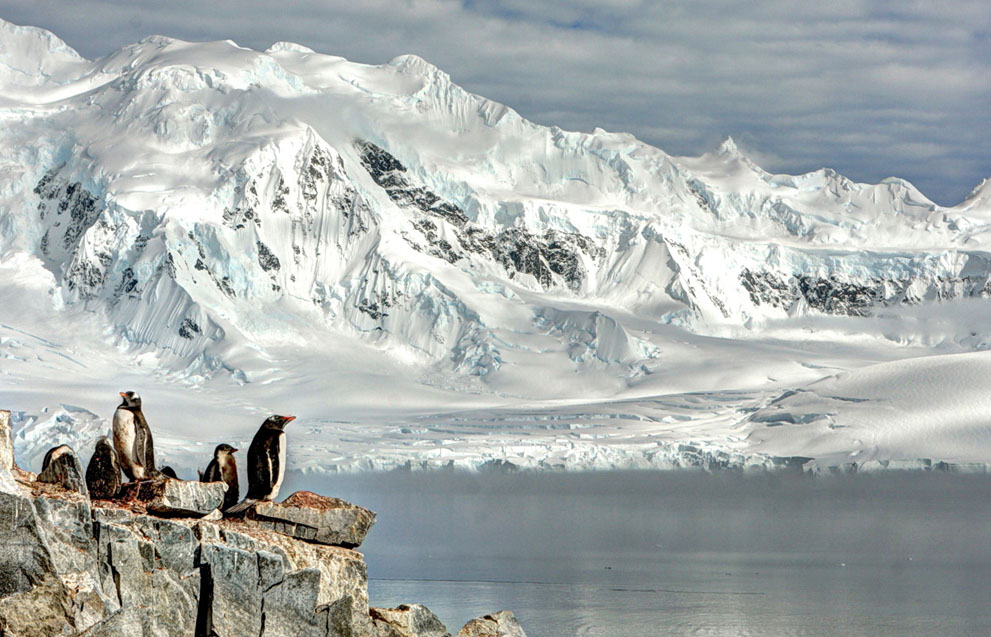
Πιγκουΐνοι στην Ανταρκτική


Ψήφος εμπιστοσύνης στα Ελληνικά μυαλά!

Τελευταία ανανέωση: Κυριακή 10 Μαρτίου 2013 08:52
Έλληνες αναλαμβάνουν την υλοποίηση πληροφοριακού συστήματος του Ευρωπαϊκού Κέντρου Διαστημικής Αστρονομίας στη Μαδρίτη
Η επιμονή στην καινοτομία, την εξωστρέφεια και τη συνεργασία, αλλά και η πίστη στις ίδιες δυνάμεις απέφεραν καρπούς για την ομάδα των ελλήνων στην οποία η Ευρωπαϊκή Υπηρεσία Διαστήματος (ESA/European Space Agency ή, «NASA της Ευρώπης») εμπιστεύτηκε ένα μεγάλο έργο διαστημικής τεχνολογίας, στα αποτελέσματα του οποίου θα στηριχτεί σημαντικό μέρος των δραστηριοτήτων της.
Το έργο που καλείται να υλοποιήσει η ελληνική κοινοπραξία, στην οποία ηγείται η εταιρεία Planetek Hellas ενώ συμμετέχει και το Εθνικό Αστεροσκοπείο Αθηνών (ΕΑΑ), αφορά την υλοποίηση πληροφοριακού συστήματος αρχειοθέτησης και διάχυσης των επιστημονικών δημοσιεύσεων για τις διαστημικές αστρονομικές παρατηρήσεις του υπερμεγέθους αρχείου που βρίσκεται στο Κέντρο Διαστημικής Αστρονομίας της ESA στη Μαδρίτη. Το έργο έχει χρονικό ορίζοντα τριάντα μηνών και ανατέθηκε από την ESA στην ελληνική κοινοπραξία μέσω ανοικτού διαγωνισμού. Αξίζει να σημειωθεί ότι η ομάδα της Planetek Hellas και του Εθνικού Αστεροσκοπείου Αθηνών είναι οι πρώτοι ελληνικοί φορείς που επιτυγχάνουν τη λήψη συμβολαίου από το εν λόγω κέντρο της ESA.
Το εγκώμιο της ομάδας έπλεξε και ο Pedro Osuna Alcalaya, διευθυντής του κέντρου της ESA, ο οποίος σημείωσε: «Ο συνδυασμός Planetek Hellas και ΕΕΑ εξασφαλίζει ιδανική ισορροπία μεταξύ βιομηχανίας και επιστημονικής κοινότητας πράγμα απαραίτητο για την υλοποίηση του συγκεκριμένου έργου. Εμείς –η ESA– θα μαθαίνουμε παράλληλα κατά τη διάρκεια του έργου αυτού και είμαι σίγουρος ότι θα αποτελέσει μια γόνιμη εμπειρία για την Planetek Hellas, το ΕΕΑ, την ESA αλλά και την Ελλάδα».
Από την πλευρά του ο Στέλιος Μπολλάνος, συνιδρυτής και διευθυντής πωλήσεων της Planetek Hellas, δήλωσε: «Η δυσχερέστατη οικονομική συγκυρία για τη χώρα μας κάνει όλο και δυσκολότερη την επιβίωση των επιχειρήσεων παντός είδους. Με δεδομένο το παραπάνω, στην Planetek Hellas είμαστε πεπεισμένοι ότι μόνο μέσω της καινοτομίας, της εξωστρέφειας αλλά και της μεταξύ μας συνεργασίας θα μπορέσουμε να υπερβούμε τα εμπόδια των καιρών. Η υπογραφή αυτού του συμβολαίου αποτελεί για εμάς άλλη μια επιβεβαίωση της αναπτυχθείσας τεχνογνωσίας στην εταιρεία μας, στον τομέα των Πληροφορικών Υποδομών Γεω-χωρικών Δεδομένων (Spatial Data Infrastructure / SDI). Πέρα από επιβεβαίωση όμως αποτελεί παράλληλα και πρόκληση για εμάς, δεδομένων των διάφορων δυσκολιών που θα κληθούμε ν' αντιμετωπίσουμε. Αισιοδοξούμε όμως ότι το έργο αυτό θα διευρύνει περαιτέρω τους τεχνολογικούς και επιχειρησιακούς μας ορίζοντες».
Άλλη μία απόδειξη ότι η θέληση του Έλληνα, η εργατικότητά του καθώς και η πνευματική του οξυδέρκεια αναγνωρίζονται παγκοσμίως.
Την ώρα που κάποιοι «εντός των τειχών» προσπαθούν μάταια να εξευτελίσουν την προσωπικότητα του Έλληνα πολίτη σε όλο τον υπόλοιπο κόσμο ο Έλληνας αποτελεί ένα από τα πιο σπουδαιότερα μυαλά παγκοσμίως!
Απάντηση στους δικούς μας «φωστήρες»!